
Make3DMap
What is Make3DMap ?
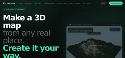
Make3DMap is a browser-based 3D map maker for turning real-world locations into editable three-dimensional terrain scenes. Users can search for a landmark, city, or coordinate, frame the exact area they want to visualize, and generate terrain from available elevation and map data. The scene can then be customized with terrain controls, surfaces, water, lighting, atmosphere, routes, pins, labels, text, and 3D objects. Signed-in creators can upload GLB models and reuse them across multiple projects. Finished maps can be published through interactive share links, embedded into websites, or remixed into independent copies by other users. For external production workflows, Make3DMap supports GLB export for tools such as Blender, Unity, and Unreal, as well as STL and 3MF terrain exports for 3D printing. The platform is suited to travel storytelling, game prototyping, education, cultural exhibits, destination maps, interactive web content, and terrain visualization.
Make3DMap's Core Features
Real-world elevation to editable 3D terrain
Search locations by place, landmark, or coordinates
Customizable terrain height and detail
Adjustable lighting, atmosphere, water, and surface appearance
Routes, pins, labels, and text annotations
Custom GLB 3D model uploads up to 250 MB
Reusable personal asset library
Surface-aware 3D object placement
Interactive browser-based 3D preview
Stable public map sharing links
Interactive website embedding
Community map remixing
GLB export for external 3D workflows
STL and 3MF terrain export for 3D printing
AI-assisted map and 3D object creation tools
Make3DMap's Use Cases
Creating interactive 3D travel maps with routes, landmarks, and destination labels
Visualizing hometowns, memorable places, and local landmarks using real terrain
Building terrain and environmental concepts for games and fictional worlds
Creating interactive geography, history, and cultural heritage exhibits
Publishing interactive event, resort, park, and destination maps on websites
Creating terrain models for further editing in Blender, Unity, or Unreal
Generating 3D-printable topographic models of mountains, cities, and landscapes
Building spatial storytelling experiences with routes, pins, text, and custom 3D objects
Make3DMap's Pricing
Free - Browser-based 3D map creation from real-world terrain
Account Required for Selected Features - Publishing, website embedding, custom GLB uploads, map remixing, and some exports require sign-in
No public paid subscription pricing is currently listed on the Make3DMap website
FAQ from Make3DMap
What is Make3DMap?
- Make3DMap is a browser-based 3D map maker that converts real-world elevation and map data into an editable 3D terrain scene. Users can choose a real location, frame the exact area, adjust terrain and atmosphere, and add routes, pins, labels, and 3D objects.
Do I need coding skills to use Make3DMap?
- No coding skills are required for the core map-building workflow. Users can search for a place, select an area, generate its terrain, customize the scene through visual controls, and publish or export the result directly from the browser.
What export formats does Make3DMap support?
- Make3DMap can export 3D scenes as GLB for continued editing in tools such as Blender, Unity, or Unreal. Printable terrain can also be prepared as STL or 3MF, while image exports and interactive web sharing are available for presentation and publishing workflows.
Can I upload my own 3D models?
- Yes. Signed-in users can upload complete GLB 3D models up to 250 MB and save them to a reusable asset library for placement in multiple map scenes.
Can I embed a Make3DMap scene on a website?
- Yes. Published maps can receive stable share links and can be embedded into websites. Visitors can orbit and explore the interactive terrain directly in the browser rather than viewing only a static image.
Can other users remix my 3D map?
- Yes. A published Make3DMap scene can be remixed by another signed-in user. The remix creates an independent copy, so changes do not modify the original map.
Can Make3DMap create terrain from real locations?
- Make3DMap can generate terrain from real-world elevation wherever supported map imagery and elevation data are available. Users can search by landmark, city, or coordinates and frame the specific area they want to model.
Can Make3DMap create 3D-printable terrain?
- Yes. Make3DMap can prepare terrain for 3D printing and export checked terrain geometry as STL or 3MF. Its print workflow evaluates factors such as topology, dimensions, orientation, and base thickness before download.